Mesaj Başarılı!
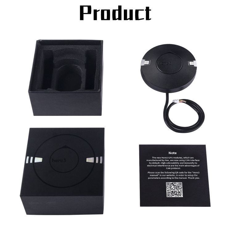
Here 3 GNSS Modül
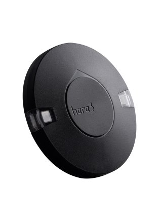
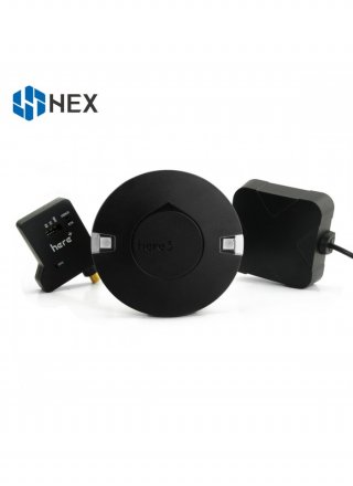
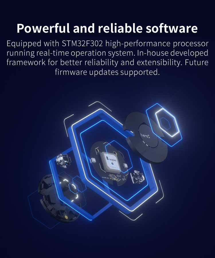
The Here3 GPS is a high precision GNSS system, which also supports RTK navigation mode, built with CAN protocol. It is also designed to be dust-proof and splash proof. Equipped with STM32F302 processor, the Here3 provides faster processing speed and better reliability.
Here3 GPS Manual
Overview
The Here3 GPS is a high precision GNSS system, which also supports RTK navigation mode, built with CAN protocol. It is also designed to be dust-proof and splash proof. Equipped with STM32F302 processor, the Here3 provides faster processing speed and better reliability.
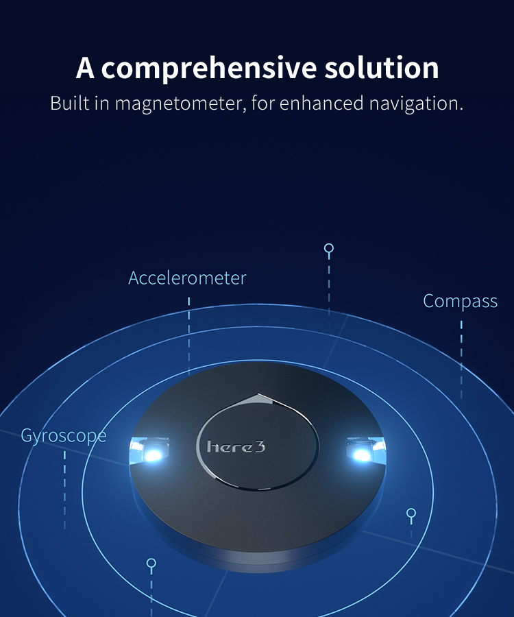
The Here3 has built-in sensors such as compass, gyroscope, accelerometer, and status LED. It runs on a Chibios real-time operation system. Its open source structure is ideally suited to developers who need specialized requirements on their navigation system.
Feature
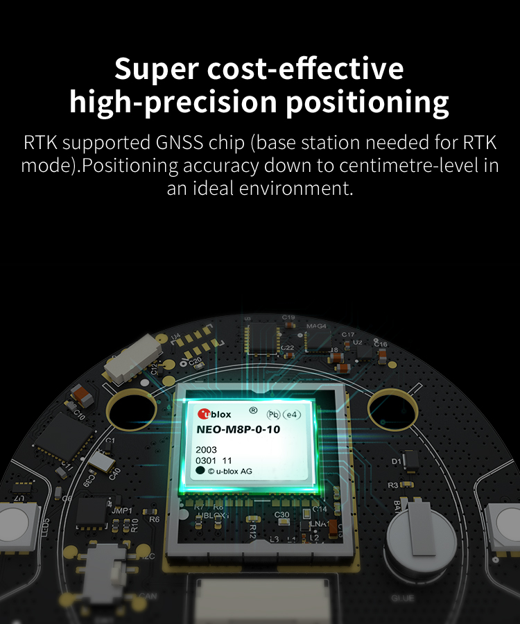
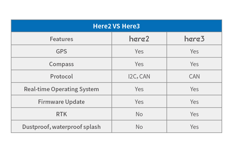
1. Cost efficient high precision and RTK supported GNSS chip (base station needed for RTK). Positioning accuracy down to centimetre-level in ideal environment.
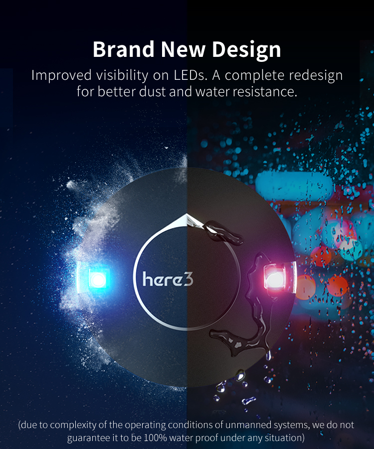
2. Brand new design with improved visibility on signal LEDs. Better dust proof and water repellent design (No guarentee to be water proof under any situation due to complexity of operation environment).
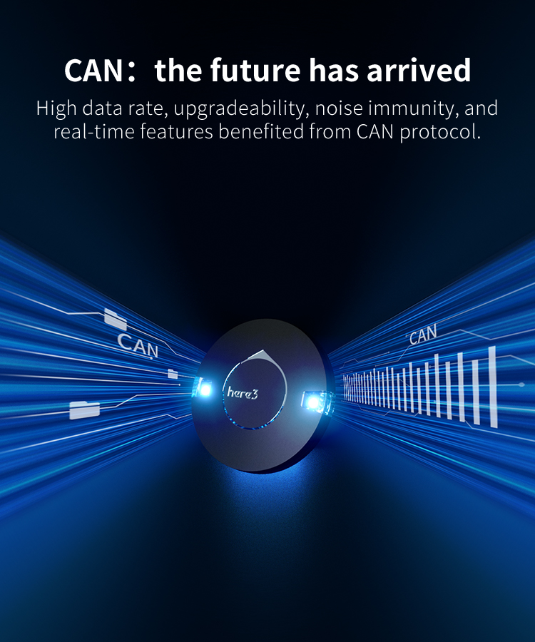
3. High data rate, upgradeability, noise immunity, and real-time features benefited from CAN protocol
4. Equipped with STM32F302 high-performance processor in real-time operation system. Framework developed by Hex provides additional stabilities. Supports future firmware updates.
5. Supporting ground control station available. Easy update from Mission Planner.
6. Built-in a complete set of Inertial Measurement Unit (compass, gyroscope, and accelerometer), which satisfy advanced navigation needs.
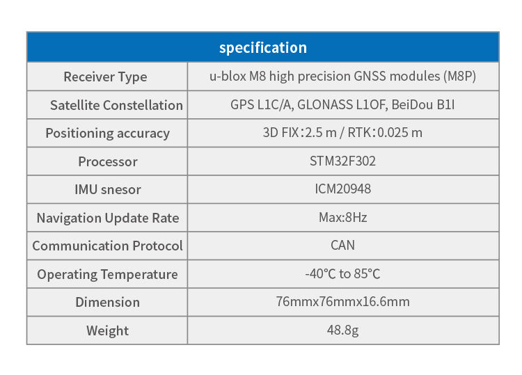
Specification
| Receiver Type | u-blox M8 high precision GNSS modules (M8P) |
| Satellite Constellation | GPS L1C/A, GLONASS L1OF, BeiDou B1I |
| Positioning accuracy | 3D FIX: 2.5 m / RTK: 0.025 m |
| Processor | STM32F302 |
| IMU snesor | ICM20948 |
| Navigation Update Rate | Max: 8Hz |
| Communication Protocol | CAN |
| Operating Temperature | -40℃ to 85℃ |
| Dimension | 76mmx76mmx16.6mm |
| Weight | 48.8g |
Pinout
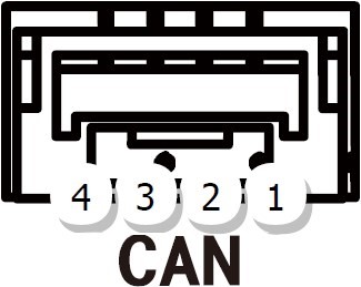
| Pin | Definition | Cable Colour |
| 1 | VCC_5V | Red |
| 2 | CAN_H | White |
| 3 | CAN_L | Yellow |
| 4 | GND | Black |
Configuration
1. Paramters Setting
Using Ardupilot Firmware:
Connect the 4pin CAN cable connector to CAN1 or CAN2 port on flight controller.
Turn on the flight controller and connect it to Mission Planner. Go to "Config/Tuning > Full Parameter List" and modify the following paramters:
CAN_D1_PROTOCOL: 1
CAN_D2_PROTOCOL: 1
CAN_P1_DRIVER: 1
CAN_P2_DRIVER: 1
GPS_TYPE: 9
NTF_LED_TYPES: 231
Click "Write Params" when done. CAN functions will be available after rebooting the flight controller.
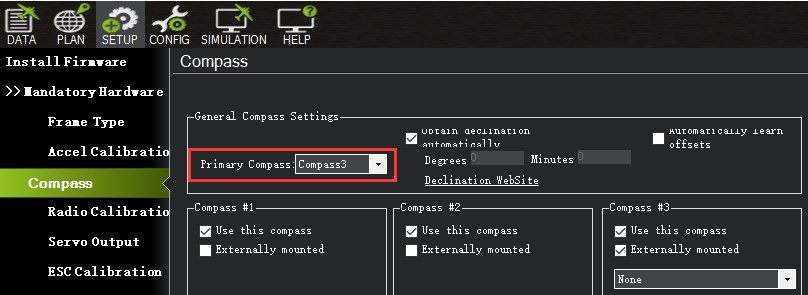
In Ardupilot Version 4.0, external CAN GPS will be set as compass 3 on Cube Black, or compass 2 on Cube Orange by default. Firmware updates in future will modify this.
Safety switch is currently unavailable. Safety switch check can be disabled by changing parameter "BRD_SAFETYENABLE" to 0. Connecting an external safety switch to GPS1 connector is also an alternative option.
If you need to use the external CAN compass as the primary compass, Set the master compass to Compass2(CubeOrange) or Compass3(CubeBlack).
Using PX4 firmware:
Connect the 4pin CAN cable connector to CAN1 or CAN2 port on flight controller. Connect the flight controller to ground control station and modify the parameter "UAVCAN_ENABLE" to "Sensors Automatic Config".
2. LED Meanings (with ardupilot firmware)
Flashing red and blue: Initializing gyroscopes. Hold the vehicle still and level while it initializes the sensors.
Flashing blue: Disarmed, no GPS lock found.
Solid blue: Armed with no GPS lock.
Flashing green: Disarmed (ready to arm), GPS lock acquired.
Fast Flashing green: Same as above but GPS is using SBAS.
Solid green - with single long tone at time of arming: Armed, GPS lock acquired. Ready to fly.
Double flashing yellow: Failing pre-arm checks (system refuses to arm). Please check pre-arm error message.
Single Flashing yellow: Radio failsafe activated.
Flashing yellow - with quick beeping tone: Battery failsafe activated.
Flashing yellow and blue - with high-high-high-low tone sequence (dah-dah-dah-doh): GPS glitch or GPS failsafe activated.
Flashing red and yellow - with rising tone: EKF or Inertial Nav failure
Flashing purple and yellow: Barometer glitched
Solid Red: Error. Usually due to cannot detect SD card (please try to re-plug or replace SD card), MTD device, or IMU sensors. Analysis can be found in BOOT.txt in SD card.
Solid Red with SOS tone sequence : SD Card missing (or other SD error like bad format etc.)
Not lighting up: No firmware detected or firmware corrupted.
| Receiver Type | u-blox M8 high precision GNSS modules (M8P) |
| Satellite Constellation | GPS L1C/A, GLONASS L1OF, BeiDou B1I |
| Positioning accuracy | 3D FIX: 2.5 m / RTK: 0.025 m |
| Processor | STM32F302 |
| IMU snesor | ICM20948 |
| Navigation Update Rate | Max: 8Hz |
| Communication Protocol | CAN |
| Operating Temperature | -40℃ to 85℃ |
| Dimension | 76mmx76mmx16.6mm |
| Weight | 48.8g |
Copyright© 2018 Geomatics Group